Topics:
Flood Prevention
Integrated Water Management Planning
Location: Curitiba, Brazil
Organizers:
Curitibal Metropolitan Area
World Bank
Year: 2004
Background: The Curitiba Metropolitan Area (RMC) is on the Upper Iguacu River Basin and had a population of 2.5 million in 2004. The river has a low capacity and historically has flooded frequently, giving rise to a large natural flood plain unsuitable for development. Several factors related to urban growth exacerbated the natural flood risks. First, beginning in the 1980s, growth pressures resulted in unauthorized development of the flood plain. Secondly, the growth of impermeable surfaces (representing up to 40% of the surface area of some basin tributaries) increased flooding in the basin six-fold. with the downtown flooding the most frequently. Finally, poor urban drainage works and infrastructure such as bridges obstructed river flow.
A 100-year precipitation and flood event in January 1995, however, caused more than USD $40 million in damages and caused the city to rethink its flood management strategy. One solution proposed would have been to increase the depth of the river, as had been done in Sao Paolo in 1986. This would have reduced the frequency of flooding in the short term, but would also lead to more unauthorized occupation in the sensitive floodplain, spread of impermeable surfaces, and ultimately worse devastation during a flood event. This option would also have been costly, having cost more than a billion dollars in Sao Paolo.
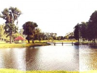
Program: In 1996, the RMC adopted an alternative strategy for flood management as part of a sanitation program developed by the World Bank. Following a series of studies on the site, the central intervention was the creation of a large public park around the main river and flood plain. The state bought the land along the river and resettled the population to other areas. An artificial channel was dug to help increase the river capacity, as well as act as a border to prevent growth into the park. Some areas were reserved for constructed wetlands to improve water quality, and a flood warning system was developed. Critically, the recreational function of the park, as well as the clear physical boundaries, reduced unauthorized occupation.
 Following creation of the park, an Integrated Urban Drainage Master Plan was developed that called for a strategic system of urban parks in the tributaries. Safeguarded by land use regulations and law enforcement, these parks help absorb precipitation runoff. Regulatory measures including new river construction standards, tax incentives for maintaining conservation areas, and integration with the urban master plan were used to conserve the parks for water storage and source control. Data is now collected to help predict floods and inform the early-warning system. Technical capacity-building of public officials and public participation in the program’s development were other components that ensured the long-term sustainability of the interventions.
Source: This case study is featured by the Associated Programme for Flood Management. View more Case Studies on flood risk prevention and disaster management here:
http://www.apfm.info/?page_id=384

